

Documents
» Show All «Prev «1 ... 8 9 10 11 12 13 14 15 16 ... 50» Next» » Slide Show
Finding our Homestead on an old Ordinance Map
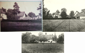
Looking at
an old map and comparing it to old photos taken of William Gooderham’s farm our
cousin Matt Ross found buildings that had the same shape and layout.
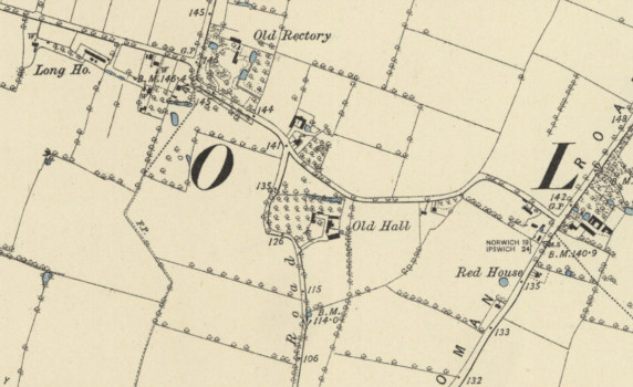
1884 Norfolk Ordinance map
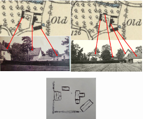
Homestead sketch by Matt Ross used to identify its location
This aerial image from 1946 shows most of the old buildings still in place, although some changes have taken place where the old "t"-shaped building in the center was located. At least one of the original buildings (farmhouse) appears to be still standing and in use.
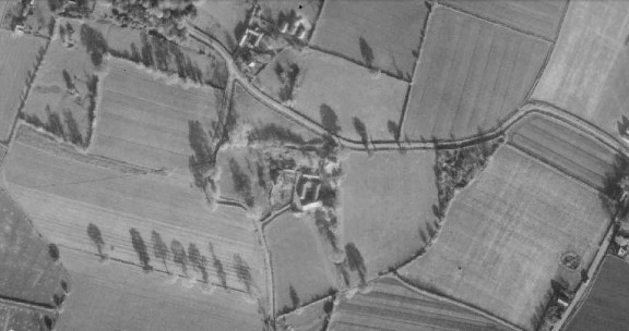
Aerial image from 1946
The heritage
listing here: https://historicengland.org.uk/listing/the-list/list-entry/1050246 contains a map that also shows some
outbuildings with the same or similar footprint to the north and north east of
the farmhouse that may or may not contain remnants of the original buildings of
the homestead.
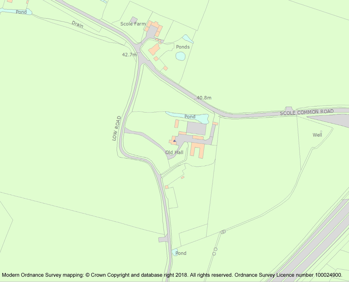
Heritage Listing Map
The rest of the current buildings appear to be newer in construction, likely replacing the original buildings on the site.
As these changes are not visible in our photographs, likely they were taken before 1946. The clothing of the man seen in two of these photographs standing in front of the farmhouse would also seem to indicate an earlier time, perhaps sometime in the early 1900s.
Our homestead photographs
The
photograph of the house from the heritage listing is very similar to our photo,
especially since the building has a chimney and half hipped thatched roof.
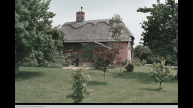
Heritage Listing photograph
Finding our Homestead on an old Ordinance Map
This document describes how our cousin Matt Ross located the site of our family homestead in Scole Norfolk and discovered it is a heritage listed building that is still standing.
| Linked to | Scole, England, UK |
» Show All «Prev «1 ... 8 9 10 11 12 13 14 15 16 ... 50» Next» » Slide Show